Glerárdalur Valley
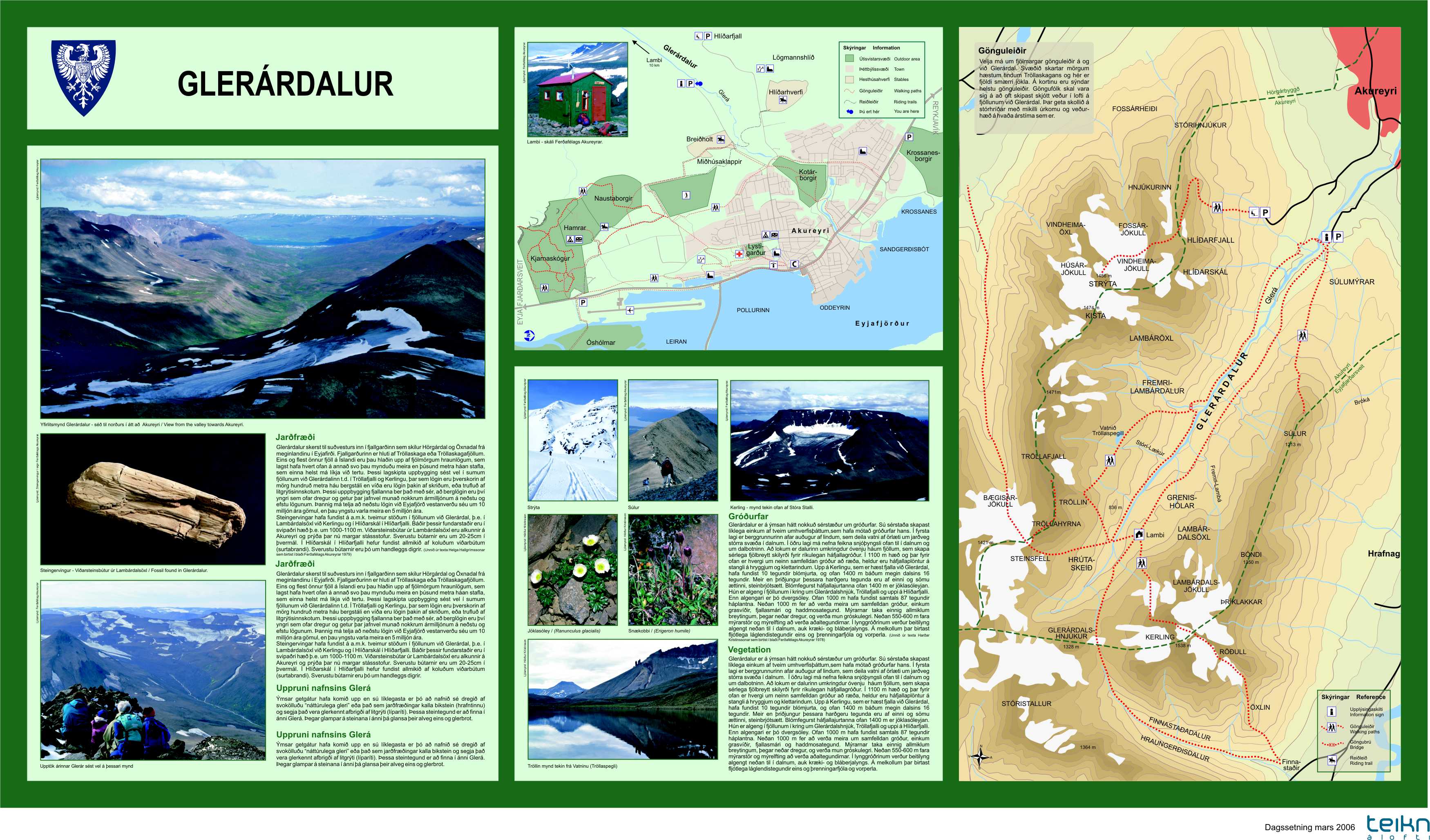
The valley Glerárdalur is a long and uninhabited valley southwest of Akureyri. The valley is surrounded by the highest mountains in the north of Iceland, the highest being Kerling (1,538 m), Tröllafjall and Vindheimajökull from 1,100 to 1,400 m high. This is a magnificent outdoor area both in summer and winter. The Akureyri Ski Resort is on the lower slopes of the mountain Hlíðarfjall which is at the opening of the valley. The river Glerá emerges from the valley and flows through the northern outskirts of Akureyri.
The Touring company of Akureyri owns a mountain cabin, called Lambi, at the bottom of the valley, about 720 meters above sea level. The cabin was built in 2014, replacing an older building on the same site. It can accommodate up to 16 persons. The hut has a kerosene operated stove for cooking and for heating. Drinking water can be obtained from a small steam arpox. 100 meters south from the hut. There is a marked walking route, 10 to 11 km from the car park for Mt. Súlur to the cabin. The area of the valley Glerárdalur offeres a great variety of interesting mountain routes, starting from the hut. Maps can be obtained by the office of the Touring Company of Akureyri (Ferðafélag Akureyrar).
Road Description:
Google maps
GPS:
65.653451, -18.172670 (65° 39.207'N, 18° 10.360'W)
Road name: Súluvegur
Distance from town Centre:
5.5 km