Glerárdalur
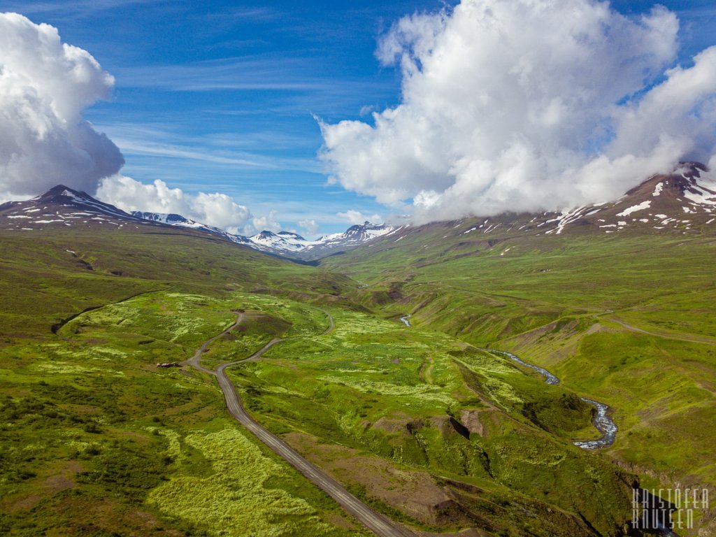
The valley Glerárdalur is named after the river Glerá that flows through it. A nice walk leads from the mouth of the valley to the bottom of it and ends by the mountain cabin named Lambi, some 11 km into the valley.
The path starts at the same parking lot as the hike to Mt. Súlur, but instead of going up and south following the yellow poles, you must continue straight into the valley along some tracks. It is a soft elevation hike, good for all ages, with a clear path that is easy to follow. Walking it to end of trail can be more challenging, as the whole hike is 22 km long (round trip).
About the valley:
The valley Glerárdalur is a long and uninhabited valley southwest of Akureyri. The valley is surrounded by the highest mountains in the north of Iceland, the highest being Mt. Kerling (1,538 m), Mt. Tröllafjall and the glacier Vindheimajökull from 1,100 to 1,400 m high. This is a magnificent outdoor area both in summer and winter. The Akureyri Ski Resort is on the lower slopes of the mountain Hlíðarfjall which is at the opening of the valley. The river Glerá emerges from the valley and flows through the northern outskirts of Akureyri.
The Touring company of Akureyri owns a mountain cabin Lambi (see photos), at the bottom of the valley in about 720 meters above sea level. The cabin was built in 2014, replacing an older building on the same site. It can accommodate up to 16 persons. The hut has a kerosene operated stove for cooking and for heating. Drinking water can be obtained from a small steam apox. 100 meters south from the hut. There is a marked walking route, 10 to 11 km from the car park for Mt. Súlur to the cabin. The area of the valley Glerárdalur offers a great variety of interesting mountain routes, starting from the hut. Maps can be obtained by the office of the Touring Company of Akureyri (Ferðafélag Akureyrar).
Map of the tail
Map of the nature reserve (the valley Glerárdalur)
Distance: 10-11Km / 6.3-7miles one way
Total time: 4+hours one way
Start/End point: Old garbage dump
Terrain: Nature trails
Parking: Old garbage dump
Interesting sights: Lambi cottage, glerárdalur valley, spectacular view